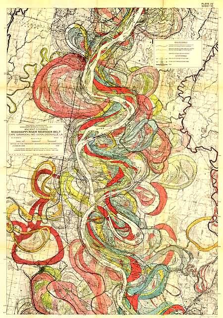
From the 1944 U.S. Army Corps of Engineers geological survey: "600 miles of meandering river belts over tens of thousands of years...If you have any interest in getting your mind blown by creative data visualization, do yourself a favor and click here now to view the hi-res map in full."
The hi-rez files are ginormous:
1. Geological Investigation of the Alluvial Valley of the Lower Mississippi River - Fisk, 1944 Report (197MB)
2. Oversized Plates - Fisk, 1944 Report (686MB)
3. Oversized Plates Rectified - Fisk, 1944 Report (369MB)
Geological Investigation of the Alluvial Valley of the Lower Mississippi River (Thanks, Marilyn!)
Previously:

Sent from James' iPhone
No comments:
Post a Comment